Pilot Project Aims to Make Trails More Accessible
Last month, Sunny Workman and Missy Kittrell were on the trails at Oak Mountain State Park south of Birmingham. They’re ultra trail runners and are at the park four or five days a week. Workman says they came upon a man on the trail.
“[He was] pushing what appeared to be a stroller,” says Workman. “We just looked at each other like, oh no, he’s lost. He really doesn’t know what he’s doing.”
But he wasn’t lost and it wasn’t exactly a stroller. He pushed it like a lawnmower. It had gadgets attached to the frame and a laptop between the handles.
“When we saw all the equipment we were like, why is Google Earth out here?” says Workman.
The man pushing the stroller, Nathan Tolbert, wasn’t from Google either. He’s with Beneficial Designs Inc. It’s a firm in Nevada.
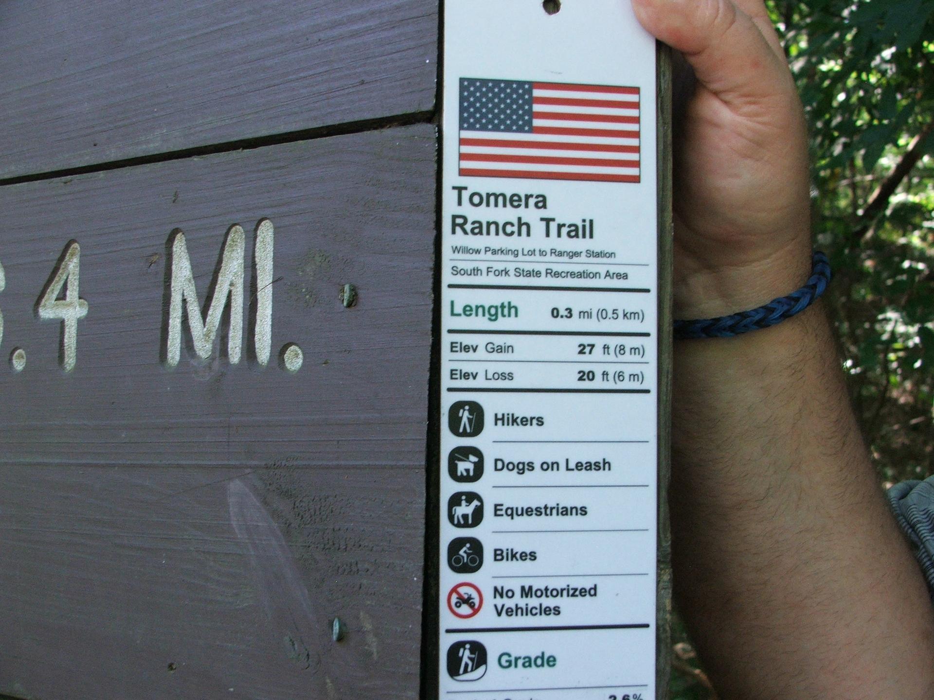
He was carefully mapping the trail, but not merely logging the route. Tolbert records information such as the grade, elevation changes, the width of the pathway, the surface hardness, and notable obstructions.
It’s tough work as Tolbert and a partner push the equipment over 38 miles of trails.
“Because you have to muscle this thing around and get it up and down and hold it and control your laptop at the same time,” says Tolbert. “And then with the cart when you’re on rugged terrain, trying to muscle that thing up and down and going over rocks. It ends up being a full body workout.”
Tolbert’s effort is part of a pilot project led by the Birmingham-based Lakeshore Foundation. The organization promotes physical activity among physically disabled individuals. This detailed information about the trails could be very helpful to those who do use a wheelchair or have limited mobility.
People such as Karin Korb.
She’s a policy coordinator at the Lakeshore Foundation and loves being outdoors. She’s also a wheelchair user. Korb says there are extra considerations she has when going on a hike.
“What’s the terrain going to be like? Can I access it with my chair? Is it going to be super hilly? Or what’s the slope? Is it going to be rocky? Is it going to be flat? Is it going to be sandy?” says Korb. “Because if I know, then I can be more prepared.”
For instance, she can switch the tires on her chair to ones that are hard, not filled with air. If she knows a trail isn’t wide enough to accommodate her chair, she can plan accordingly.
“If there was a sign that says, hey, this is a two-point-five percent grade, then I know that it is going to be what we consider fairly flat,” says Korb. “I’m cool with that.”
That’s where this project leads. All that mapping information will be distilled down into signs that are kind of like a nutritional label for each trail. It’s a lot more detail and a lot more helpful than simple descriptions of easy, medium or difficult and all in an effort to make the trails at Oak Mountain more accessible.
La'Nissi Brown,WBHM
A sample sign
The focus may be those with physical disabilities but organizers say the information is helpful for anyone planning a hike. Nathan Tolbert says his requirements are different from a wheelchair user but still can be informed by the trail mapping.
“When I go out with my son, I want somewhere that’s short and has maybe a destination along the way, a creek passing, not too steep and not too soft,” says Tolbert. “Otherwise, he’s going to be tired and I’m going to be carrying him.”
Ultra trail runners Missy Kittrell and Sunny Workman say they know the park pretty well but it will be helpful to have accurate measurements for the trail.
The $48,000 dollar project is supported by Lakeshore along with grants from the federal government and the Munson Foundation, a group that’s given to environmental causes. The money goes to purchase mapping equipment, plus a program to train people in Alabama so other trails can be mapped.
And those trail nutritional labels for Oak Mountain State Park, a.k.a. the signs, are expected to go up next month.
Alabama coal mine keeps digging after hundreds of fines and a fatal explosion
Following the death of a grandfather, Crimson Oak Grove Resources has left a community afraid for their homes and lives. An expert warns one resident may need to evacuate her home while she still can.

Florida’s 6-week abortion ban will have a ‘snowball effect’ on residents across the South
Abortion rights advocates say the ban will likely force many to travel farther for abortion care and endure pregnancy and childbirth against their will.
Attitudes among Alabama lawmakers softening on Medicaid expansion
Alabama is one of ten states which has not expanded Medicaid. Republican leaders have pushed back against the idea for years.

Birmingham is 3rd worst in the Southeast for ozone pollution, new report says
The American Lung Association's "State of the Air" report shows some metro areas in the Gulf States continue to have poor air quality.
Why haven’t Kansas and Alabama — among other holdouts — expanded access to Medicaid?
Only 10 states have not joined the federal program that expands Medicaid to people who are still in the "coverage gap" for health care
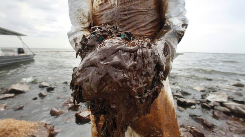
Once praised, settlement to help sickened BP oil spill workers leaves most with nearly nothing
Thousands of ordinary people who helped clean up after the 2010 BP oil spill in the Gulf of Mexico say they got sick. A court settlement was supposed to help compensate them, but it hasn’t turned out as expected.